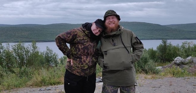
Kaldoaivi hike 2019
Kaldoaivi hike 2019
Here’s another set of stories from the fells of Lapland by Tero and Essi. This time about their hike in the Kaldoaivi wilderness area in August 2019.
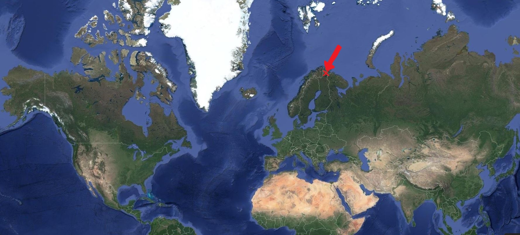
Kaldoaivi on the world scale.
We once again felt the call of the wilderness area of Kaldoaivi in August 2019. It is the biggest of its kind in Finland, located in Utsjoki, Lapland and its area is almost 3,000 km2 (c. 1,150 square miles).
Our plan was to try to avoid other people and find our own trails without any set daily distance goals. We would take a shortcut from the parking lot at the lake Pulmankijärvi to the mountain bike trail and continue from there to the top of the Galddoaivi fell that has given the name to the whole area. From there we would continue along our own trails towards the lake Ylä-Pulmankijärvi and the nearby Adolf’s peat hut and the German Junkers Ju 52 that crash-landed there during WWII. And then we would continue back to lake Pulmankijärvi.
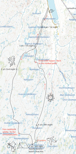
Our route on the map.
We tried to take along a lot less stuff than we had with us on the previous year’s Halti trip. I managed to lose about seven kilos from my backpack. The biggest difference came from switching from a hydration reservoir to a water bottle and taking a lighter backpack and lighter food. Essi’s backpack also became five kilos lighter. Because the weather was warmer and we didn’t climb as high this time, we packed fewer clothes along. We did pack fishing rods for a few possible fishing spots. We also checked out the local fishing regulations and possible limitations and acquired the required permits beforehand.
Essi: It was awesome to be able to return to Lapland that we love so muh, especially after such a hectic and work-filled summer! We embarked upon our journey the day after Lekafest. We had an overnight stay in Jyväskylä in central Finland because we got such a late start. The next day we continued to Pulmankijärvi, where we arrived in the evening, after driving more than a thousand kilometers (more than 620 miles).
Day 1 Monday
The road leading to lake Pulmankijärvi isn’t called one of the most beautiful roads in Finland for nothing. We arrived at the parking lot a couple of hours before the sunset. Then we switched from shorts and t-shirts to the hiking gear, and soon we were in the bush with our backpacks looking for the mountain bike trail. When the sun started setting, we were crossing a swamp with mosquitos buzzing in our ears and our feet squelching in the swamp. This is what we had been waiting for the whole summer!
Finding your way in the dark isn’t the easiest or the most sensible thing to do so we walked at a brisk pace to be able to find the bike trail in time. The clouds started gathering above us about the same time the sun went down. We found the trail conveniently just before the dark. It was clearly made with a quad bike, so it most likely lead to a reindeer herders’ cabin in the wilderness. The trail was so visible that it would have been difficult to miss it even after the dusk.
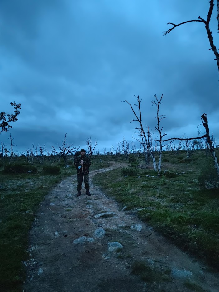
The northern summer night.
We continued after the sunset for a couple of kilometers until we were officially in the wilderness. We set up our camp around midnight amidst the mountain birches on the shores of a small, gloomy-looking lake. Sleep came quickly after a long hard day.
Day 2 Tuesday
Siberian jays greeted us happily in the morning. The eerie feeling was gone and the campsite looked very welcoming in the sunlight. We were happy to notice loads of bilberries around us, and Essi picked them for our morning porridge. After eating, we filled our water bottles from the lake, packed up our camp, and continued our journey. The wind picked up but the sun was still shining brightly, although the clouds shrouded it every now and then. The fall colors had started to creep in here and there. After all, it was already late August. We also started spotting some reindeer on both sides of the trail after a few kilometers.
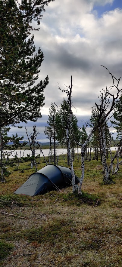
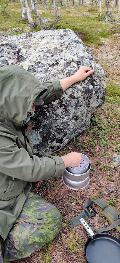
The first campsite and morning porridge with bilberries cooked on a Trangia.
During the lunch break we did some fishing from the shores of a small lake. However, that was cut short when dark clouds emerged over a nearby fell, and soon it started to thunder and rain heavily. As we packed up our stuff, a couple of hikers came by and stopped to talk. We weren’t that conversational this time since we yearned to get on our way again. The rain stopped when we got our packs on and continued our trail uphill to the fells. However, after a few kilometers, the weather got gloomy again. We decided to stop at the next good enough spot and camp for the night to avoid the worst of the thunder and rain.
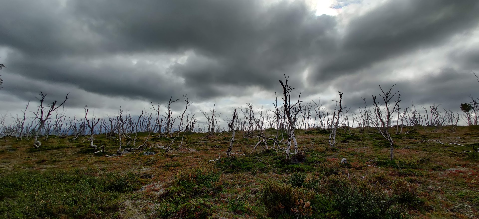
Sometimes the weather changes rapidly.
Luckily we found an even spot among some mountain birches, which on top of everything was in a large depression. We were too tired to fill the water bottles in the evening. During the night we heard the thunder rumbling above the faraway fells, and we could see the lightning flash through the tent fabric. Lying there in the middle of nowhere, you suddenly felt very tiny. As I got up to take a piss in the small hours of the night, a thick mist had surrounded our campsite.
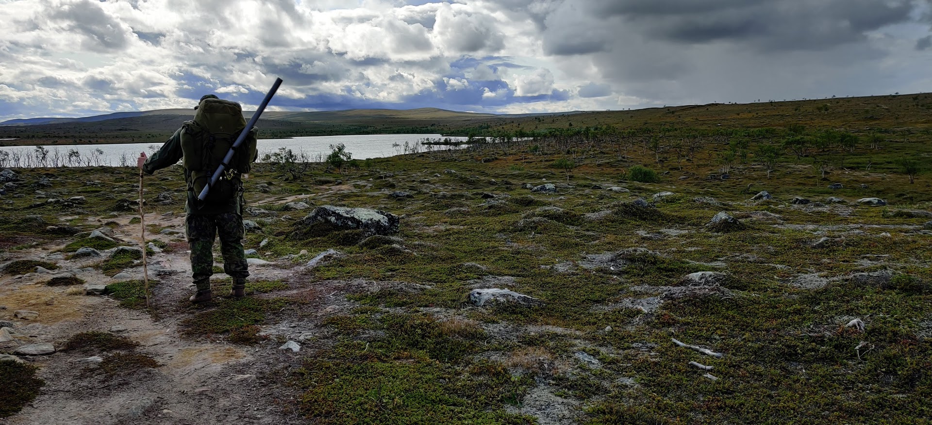
Searching for fishing spots.
Day 3 Wednesday
In the morning, the mist had cleared a bit. We had a quick breakfast, gathered our things, and decided to fetch some water. To our dismay, we realized that the water spot that looked nice on the map was dry despite all the rain.
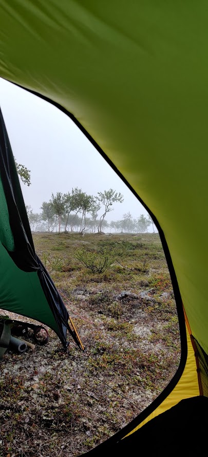
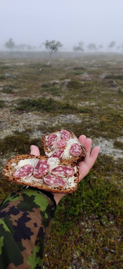
Morning mist and a quick breakfast, proper dark Finnish rye bread of course.
Well, the maps aren’t always that accurate when it comes to small streams and puddles. So, we had no choice but to dig out the map pouch again and start looking for a new oasis. We had to make a slight detour to find the next stream that seemed to be the only one nearby. We left our backpacks behind and walked about a kilometer to find a small river flowing through a ravine where we could fill our bottles. The scenery was so magnificent that this detour would have been worth just for that alone. This day’s journey was primarily uphill.
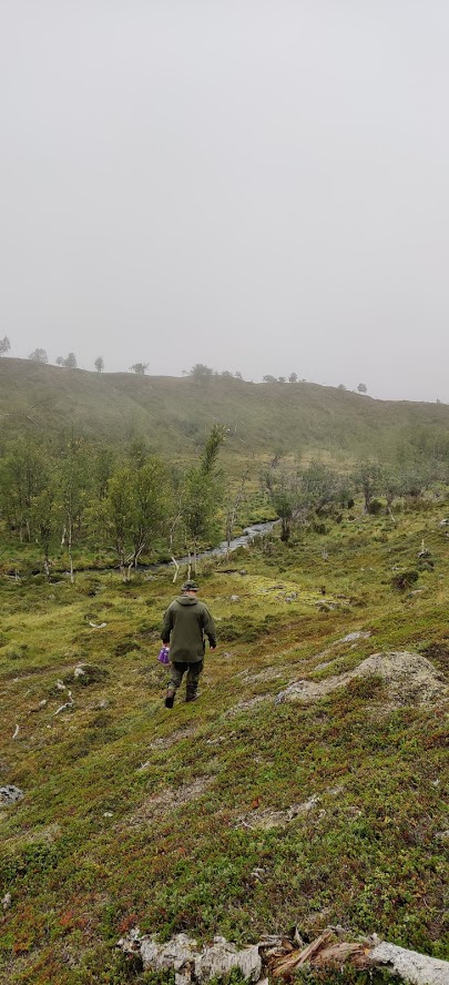
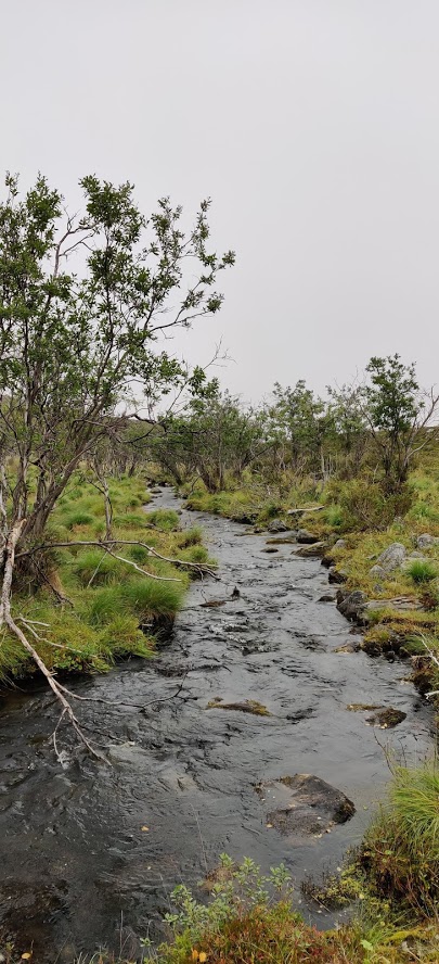
Getting water from a stream that looked a lot bigger on the map.
Some landfowl were observing us. They looked like black grouse, but they might have been willow grouse or ptarmigan since we were close to the top of the fell. We started feeling super hungry even though it had only been a few hours since breakfast. So, we stopped to have a second breakfast like the Hobbits do on the slopes of the Galddoaivi fell. The slopes were soon shrouded in the mist, but equally fast the mist cleared as we got through our quick meal.
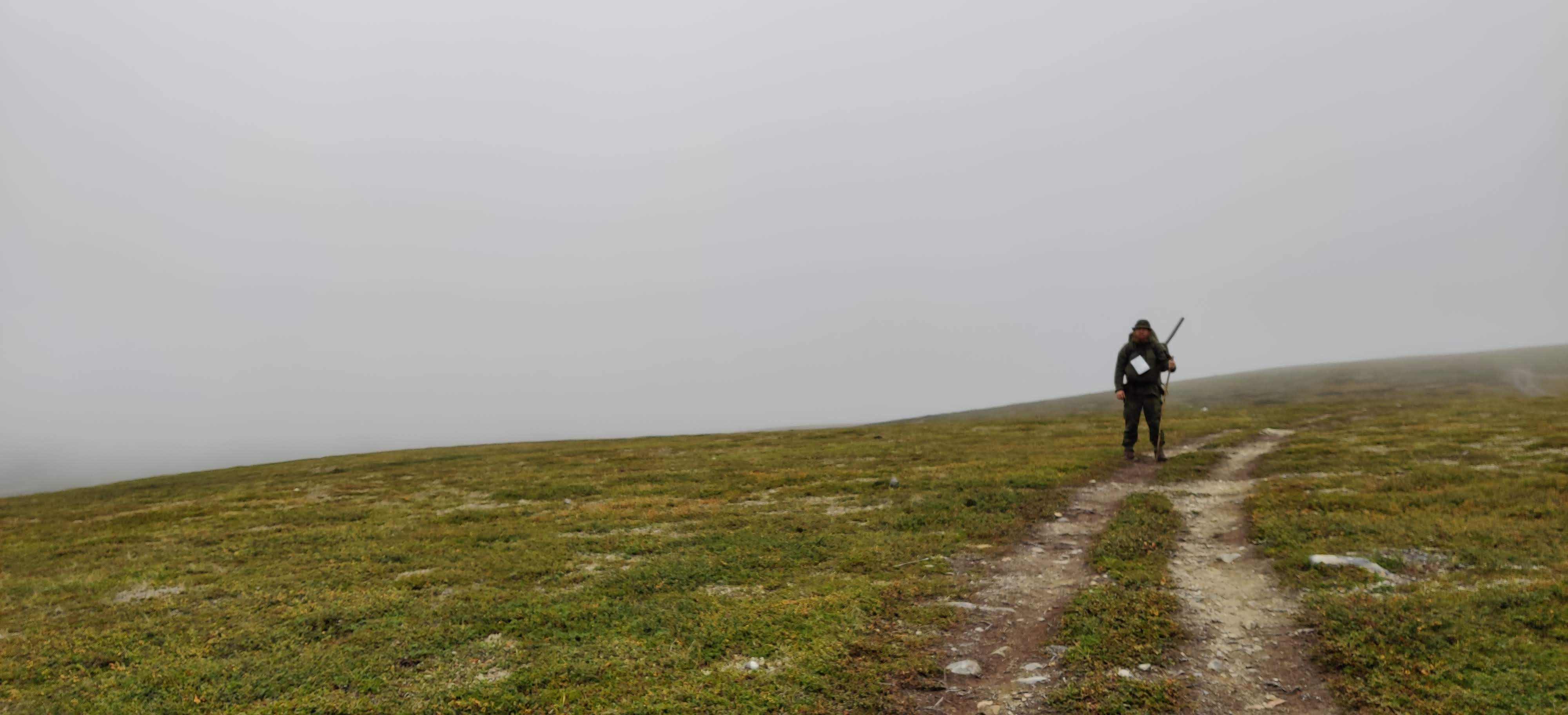
The mist starts to cover the peak of the fell.
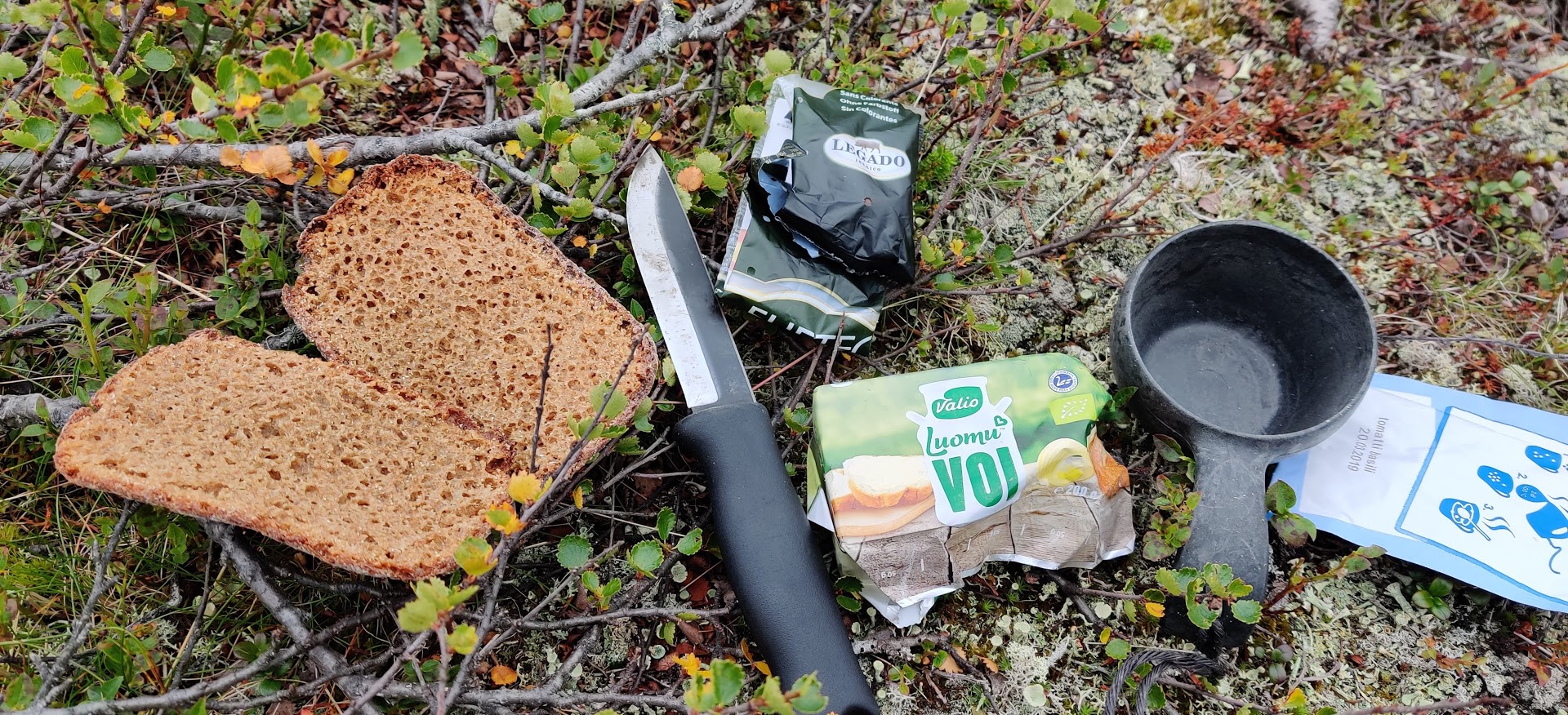
Second breakfast of the champions. Rye bread, butter, and salami.
After eating, we continued along the trail until the quad bike tracks turned in a different direction and the clear path disappeared in the swamp. Luckily one could see bike tracks here and there. I have to say that I didn’t envy those who had been cycling or trying to cycle in this quagmire. We willingly took a detour around the swampiest parts. The sky was once again clear and we could spot brightly colored people from afar. However, we deviated from the path before meeting them after climbing on top of the Goallagotteoaivi fell to check the weather. Dark clouds were rapidly nearing us and it was already raining a few kilometers away. The weather was clearly indecisive today.
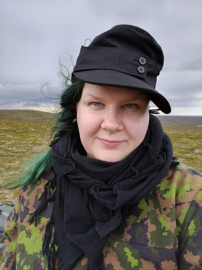
Fresh adventurer.
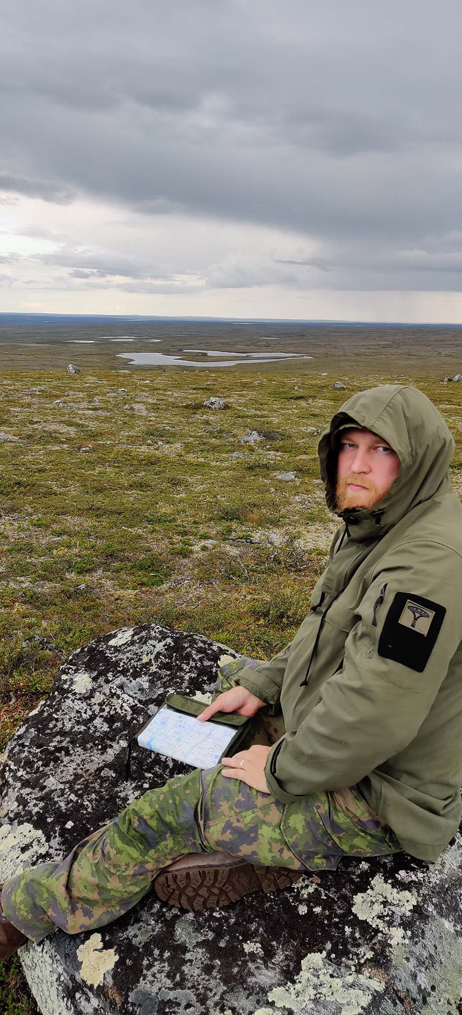
Orienteering on a map.
We prepared for the inevitable by putting on some rain gear before continuing our hike. Walking through the rain was starting to test our spirits since we were both hangry. Our feet remembered the uphills quite bitterly as we stopped to cook a late lunch in still continuing rain next to a small lake. This puddle was also a lot drier than it had looked on the map. We emptied the Blåband bags quickly, and with nourished bodies our walking pace was once again quite nice. We went across a swamp towards lake Ylä-Pulmankijärvi using the GPS. After the swamp the scenery was very favorable as we could see the beautiful lake down below us, and hear a waterfall in the background.
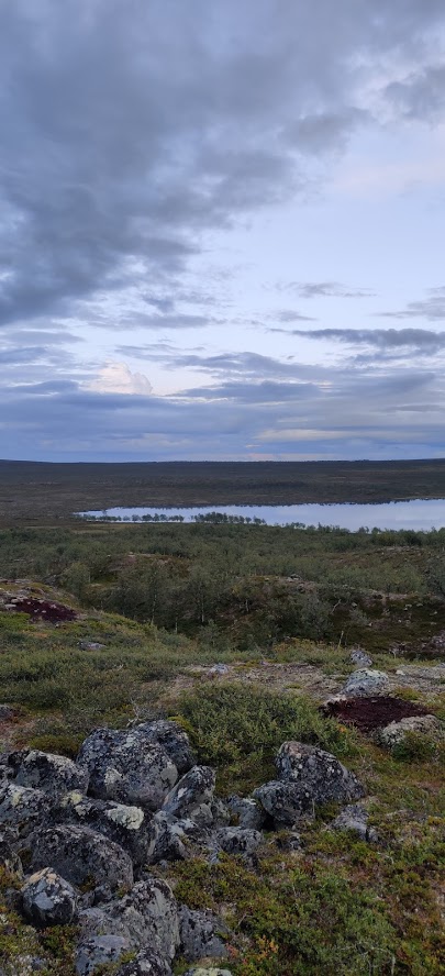
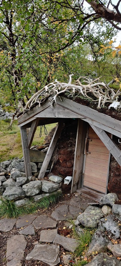
Ylä-Pulmankijärvi lake and Adolf’s peat hut.
We took some time to find the Adolf’s peat hut a bit lower. It is a low peat-roofed hut built in the 1960s. It is said to be named after the pilot of the Junkers Ju 52 transport aircraft that was shot down nearby during WWII. According to a rumor, the pilot was named Adolf and he died during the crash landing. People claim he occasionally haunts in the hut, especially after somebody had dragged the pilot’s bench inside. We didn’t dare to sit on it in fear of possible supernatural encounters at night. The hut had a few beds, a stove, table, bench, and various cooking tools. There was also an outhouse, oh what luxury!
Whether it was the ghost stories or not but Essi wasn’t that keen on sleeping inside so we set up the tent quickly next to the hut, watching the rain clouds drift closer. It didn’t rain that much so we prepared a tasty noodle-tuna dinner at the fire pit next to the hut. It had been an eventful day so we retired to bed quite early. We had some biblical moments when frogs and voles started squeezing in the tent. A stubborn vole had to be chased away from our backpacks several times. Perkele. Essi argued that we cannot murder the vole because we are guests in its home. Yes, she was right, we were the visitors. However, the host could stop trying to steal the guests’ food in the middle of the night at least.
Essi: On the third day, the kilometers started to feel heavy but luckily our spirits were lifted by the great scenery, fantastic company, and persistent earworms. Time goes by surprisingly quickly when you try to remember the lyrics of various songs. Maybe it is a sign of relaxation when the brain gives space for "unnecessary" things, which is really good!
Day 4 Thursday
We slept rather poorly. I wonder whether Adolf should have been given some peace offerings, maybe a shot of booze or something to ensure sweet dreams?
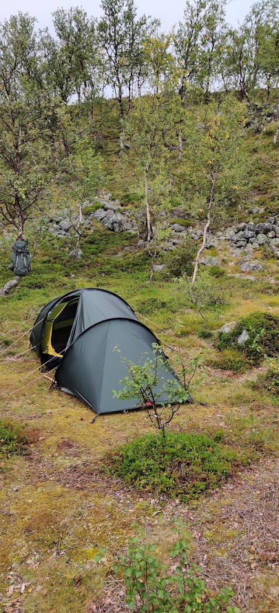
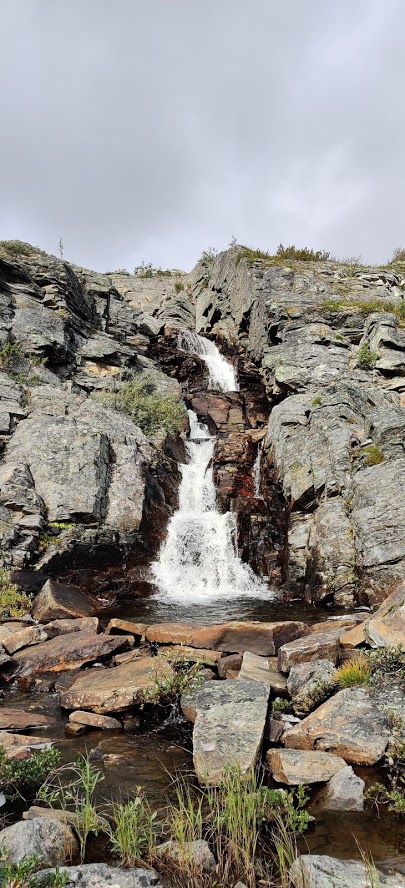
Outdoor spa and our five star accommodation.
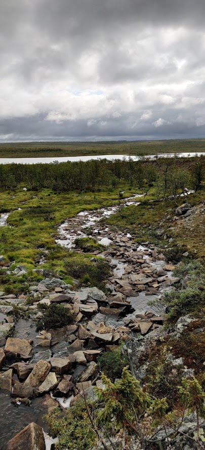
A stream flowing to Ylä-Pulmankijärvi.
The first thing we did in the morning was to check out the waterfall close by and take a bath in the stream. Quite a view at this outdoor spa. After washing up, it was time to cook some porridge on the Trangia, with a hefty dollop of butter and some berries, which got eaten inside the hut because it rained again heavily.
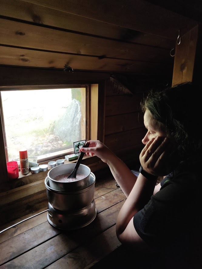
Inside the peat hut sheltering from the rain.
While eating, we had time to plan the upcoming day. We decided to spend a relaxed day exploring the surrounding areas and fishing at the Ylä-Pulmankijärvi lake. So, after the breakfast we left the tent where it was, shoved the backpacks inside it, and went looking for the crash-landed Junkers.
This German freight plane was shot down during the Lapland war in 1944. At the time, Finland was fighting against Germany in Lapland. A Russian fighter plane destroyed the engines and the plane was forced to land in a small pond. This is how 6,500 kg of German aircraft engineering ended up near Ylä-Pulmankijärvi. This isn’t an isolated incident, however. About 100 WWII airplanes are scattered in different parts of Lapland.
A surprisingly large portion of the plane was still intact even though hikers have taken bits and pieces along as souvenirs during these decades. The crew had destroyed the cockpit themselves, and the hull still bore the holes made by the 20 mm ŠVAK autocannon. One person died but others made it back alive. This 75-year old monument in the middle of the wilderness made you wonder. Did the crew get back on their own or were they picked up by somebody? Did they survive the rest of the war and if they did, what kind of stories did they have for the future generations?
Essi: For me the most startling thing about meeting Aunt Ju was the realization of what could have happened if the pilot hadn’t been able to stop the plane in time. Just a couple of meters after the landing spot, there’s an edge of a cliff (visible in the pic below). A couple of funny details: actually there was nobody named Adolf on the plane and the pilot survived the crash.
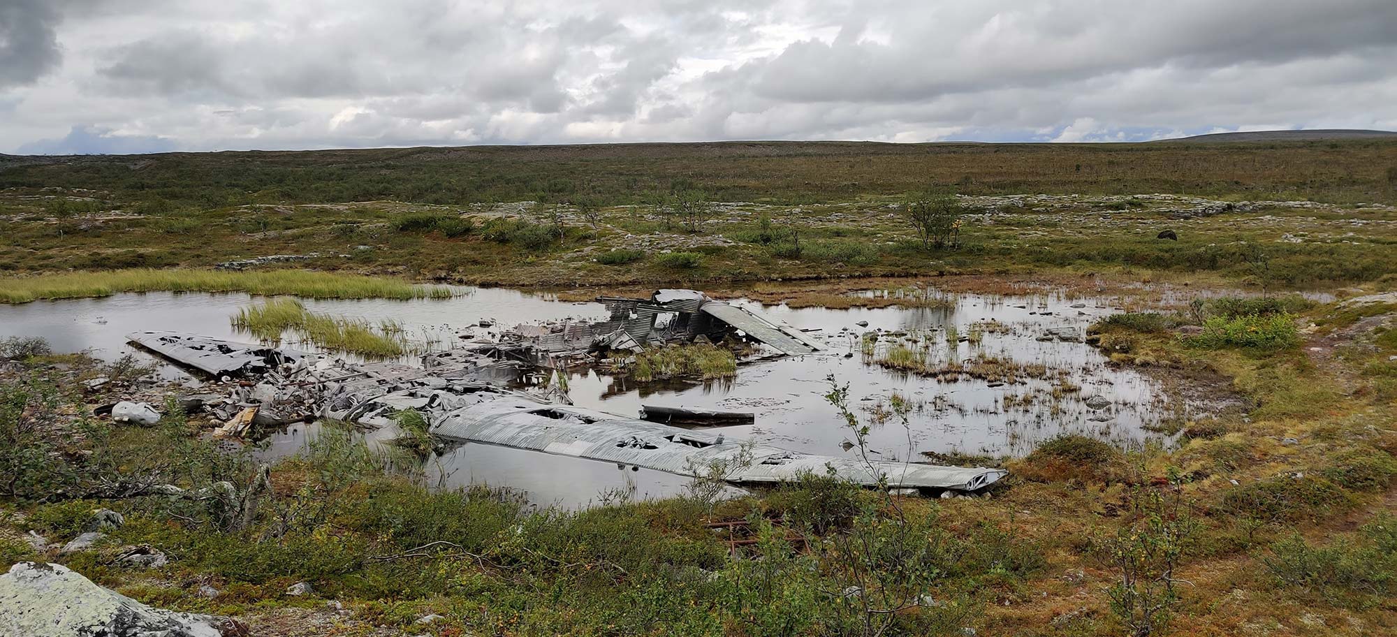
Here lies Aunt Ju.
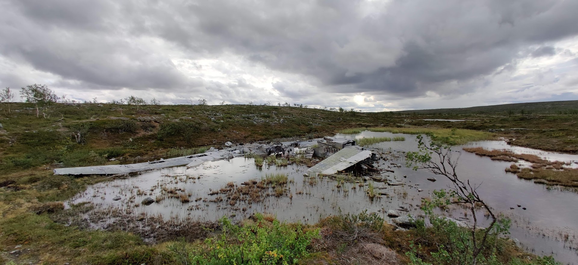
Very close to the edge.
We had to cross the river Pulmankijoki in both directions but we managed to do it without getting our feet wet. When we got back to the hut, we were already starving.
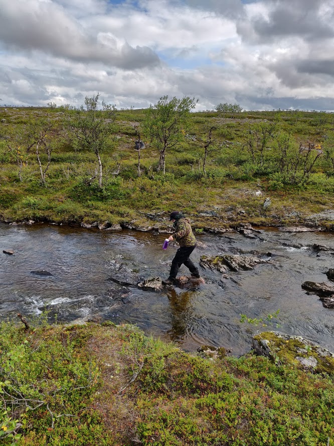
Crossing the river with dry feet.
During lunch preparations, we heard some rustling where our backpacks were located. The same damn vole was trying to break into Essi’s backpack. The side pocket of the backpack had a plastic bag for trash that interested the vole so much that it gnawed a hole into it. After this episode, we named the vole Aatu. After some investigating after the journey, we came to the conclusion that it might have been a red-backed vole that is protected. We also found out that many of the rodents in Lapland are protected.
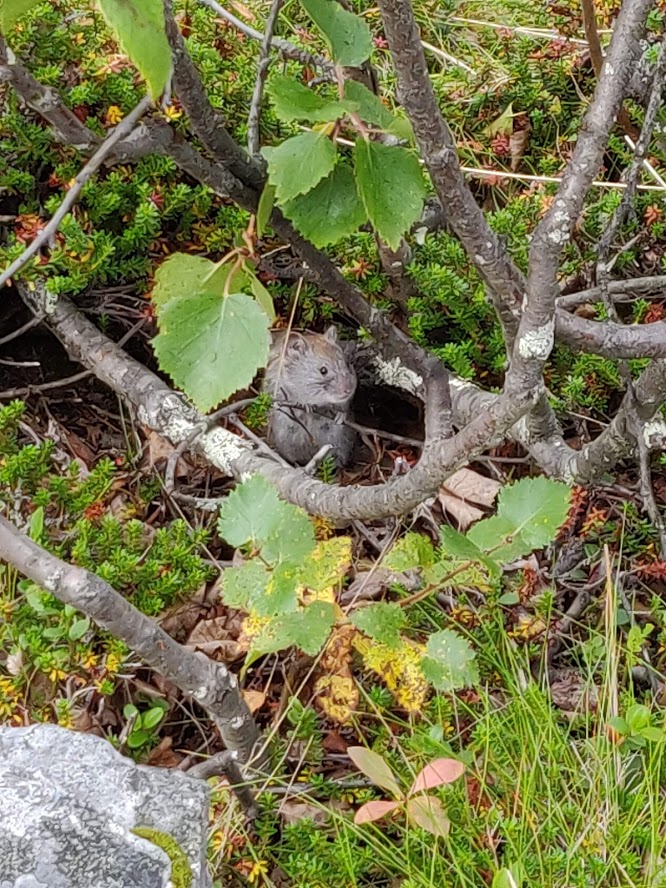
Aatu the vole.
The vole started bugging Essi to some extent so we decided to pack our stuff and continue towards the lake that had a really cool beach and an old fire pit. We spent a casual afternoon fishing and caught a nice-sized pike that we released back in hopes of catching a grayling instead. Well, no luck in that department but at least we had fun trying. We saw a couple of travelers heading towards the hut. They looked like the ones we met a couple of days ago. After a relaxing day we headed out again and said farewell to Aatu.
Essi: Damn what a character that Aatu. We haven’t seen such a bold rodent before. Stomping our feet, clapping our hands and loud voices did nothing. We constantly had to try to chase him away from our packs. Well, he was cute nevertheless.
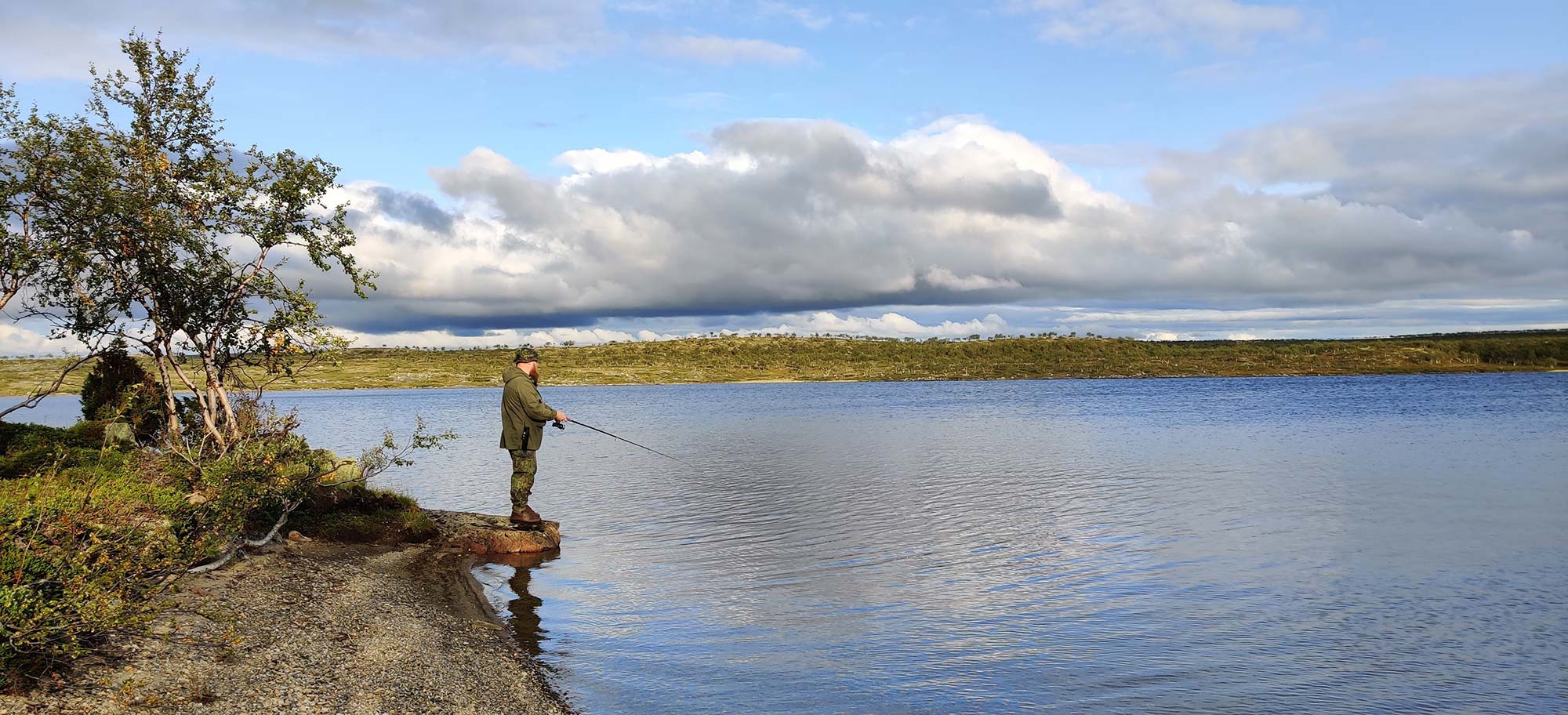
Fishing time.
We walked along the river for a while until we reached an upland area that had lots of birches killed by the autumnal moth. Most of them probably in 2011 when the moth wreaked havoc in Lapland. The landscape was lovely as the sun set behind the fells and cast long shadows on the small birches.
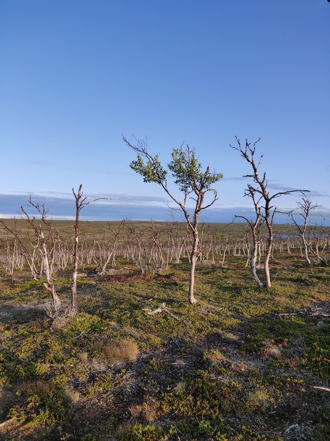
Birches destroyed by the autumnal moth.
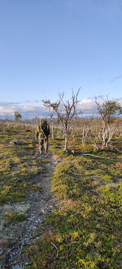
The evening sun is still shining.
The north wind started picking up in the evening. We crossed several small streams that flowed along the bottom of beautiful small ravines. We had checked some possible camping spots on the map beforehand but none of them seemed suitable when we finally got there. So, we ventured onward until the sun started descending behind the fells. Finally, we found a small valley where the ground was even enough, and there also was a small pond, and a sandy beach. The beach seemed otherwise perfect but our light tent pegs were unsuitable for such a sandy ground in windy weather.
The day had been long and we could hardly keep our eyes open, so it was vital to find a good place for the tent soon. Finally, we located a spot a bit higher up that both could accept. Essi set up the tent while I cooked us some supper on the Trangia. The place wasn’t very sheltered so the wind shook the tent quite vigorously at night. However, we had slept in this tent in a lot stormier weather and weren’t that worried. The temperature also dropped after the sunset closer to zero Celsius.
Day 5 Friday
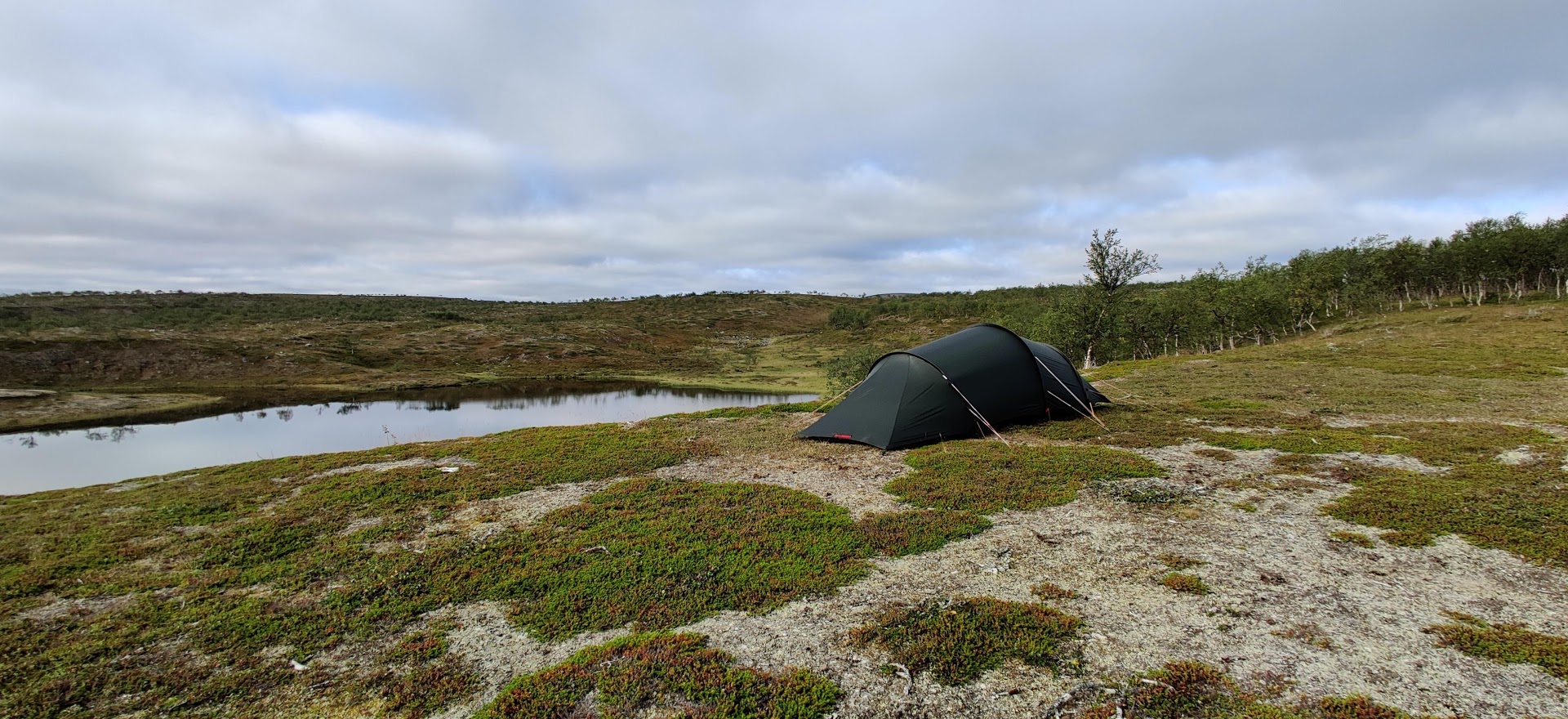
The only relatively flat spot in the vicinity.
Essi felt cold during the night but I had to open the zipper because I got overheated in the sleeping bag. We have similar Carinthia Defence 4 sleeping bags but I guess our internal heaters work a bit differently. Quick porridge, packs on the back, and finding our way on the map. Half the day was easy hiking so we moved at a fast pace.
We used the Tsuomasvärri for orienteering when the visibility was good. It is a fell that we ascended a couple of years ago along the Sevettijärvi-Pulmankijärvi hiking trail. The weather was fantastic, the sun was shining, and there were only a few small clouds here and there. It was hot and dry and ground crackled under the feet despite all the rain. We saw large birds of prey gliding above us several times during the day. Possibly golden eagles or even the rarer gyrfalcon. It was impossible to say because they were flying so high.
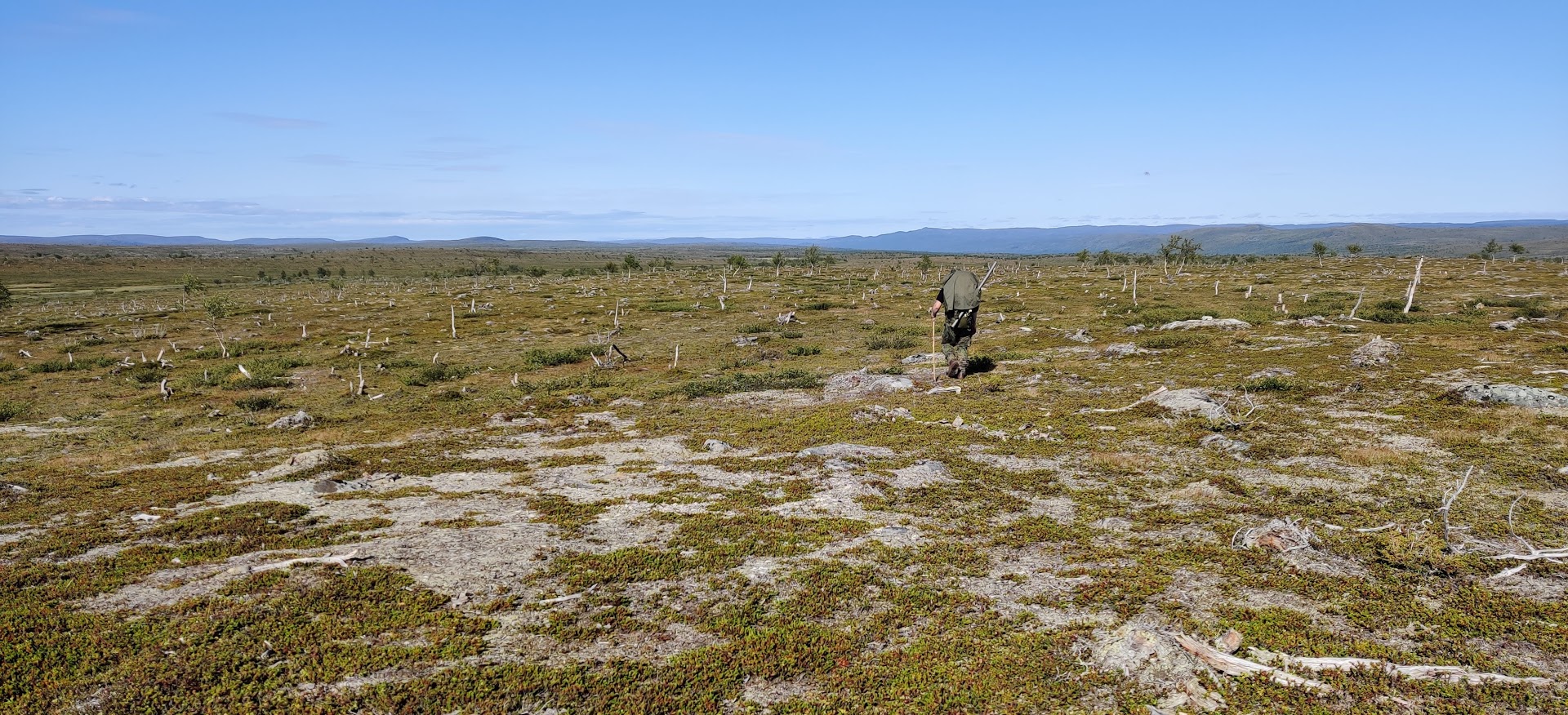
The sun was blazing hot all day.
We had a lunch break by a small secluded pond that had a swan family enjoying the sunny day. We selected the spot because of a single small mountain birch where we could hang some of our clothes and a Shemagh scarf to bring some shade. And we had chocolate mousse for dessert!
We crossed a few smaller streams and one a bit bigger river. Even though the river was more than ten meters wide, we could get across with dry feet thanks to the map and dry summer. We could also utilize the rocks for taking a break and taking care of our feet. It was fantastic to dip one’s feet in the cold running water. Some of the other streams were completely dry and even the bigger river had very little water.
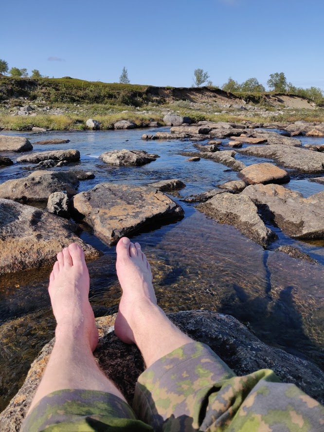
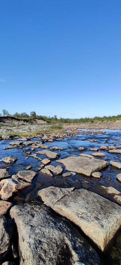
Water was very low because the meltwater was long gone. A nice break, some water and air for the feet.
After the crossings, we ended up in a really swampy shrubbery that wasn’t on the map. We double-checked everything on the GPS but were still certain we were in the right place but the contraption claimed that it was easy terrain. Going around the place was even less attractive. So, we spent the next two hours cursing through the shrubbery, surrounded by mosquitoes and biting midges. Going around it would probably have taken equally long. Perkele. Luckily we climbed higher and the mosquitoes disappeared in the wind. We were running low on water but luckily the map claimed that there were several small ponds along the trail. Well, when we got to them, they were all dry or muddy sludge.
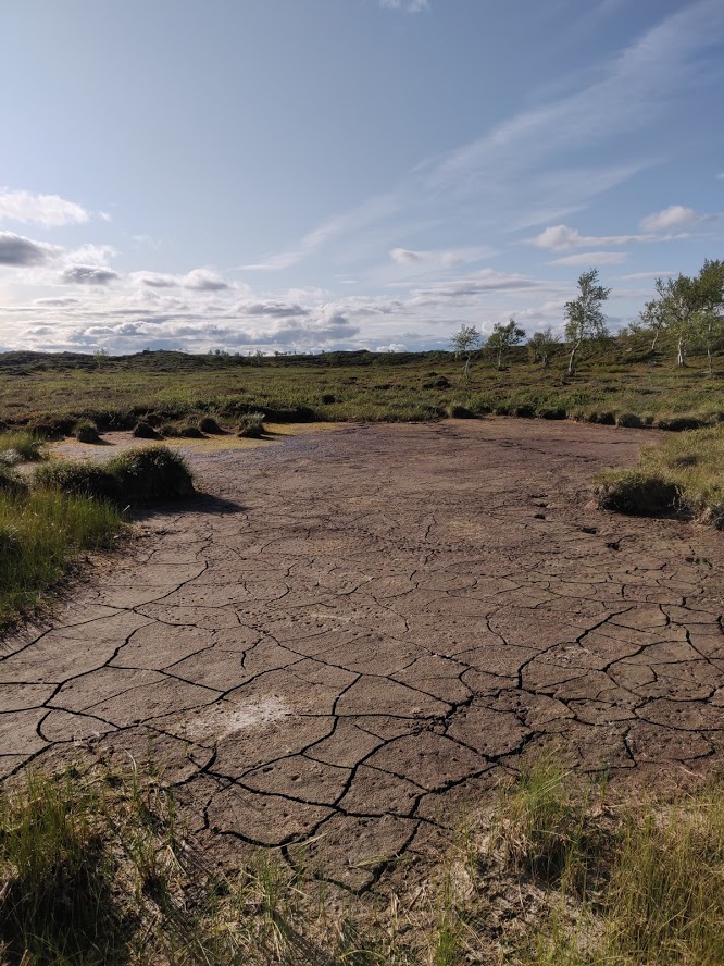
Most of the ponds marked on the map looked like this.
We continued from mud hole to mud hole until we simply had to accept any kind of sludge for drinking and cooking. The muddy crap was so thick that pumping it through the filter was a lot more difficult than anywhere else. On top of everything, Essi ate some epic Indian stuff while I had to be content with tasteless soup. A thought that some people are luckier than others did enter my mind even though it was I that had chosen my rations in the first place.
The road went on and on, this time through small rocky hills. After a couple of hours, we reached the quad bike tracks leading back to the route that we had taken in the beginning. We started looking for a place for out tent next to a couple of lakes. However, the ground wasn’t flat anywhere and there were craploads of rocks all over the place.
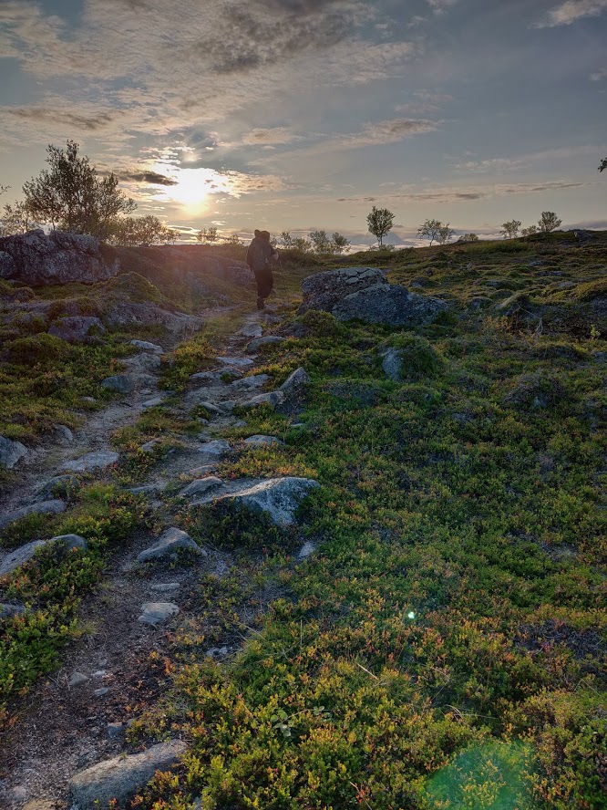
Trying to find the last camping spot.
Eventually we found a place that wasn’t exactly level and had some rocks but was good enough for one night. When pitching the tent, I noticed that my Terävä Jääkäripuukko had disappeared along with the sheath. What the actual fuck? The last time I remembered seeing it on my belt was when we left our previous camp and I hadn’t used it during the whole day. Around noon I had to open the belt when taking a dump. I guess the knife is somewhere close to that improvised toilet. I wanted to go back to find my precious but we had walked a work day’s worth of hours since then. And Essi didn’t consider an overnight hike just to fetch a knife that sensible.
So, we didn’t get through this journey without losses. That knife is a survivor though. I have gone through all sorts of things with it all over Finland. I bet it will survive longer in the wilderness than I ever could, and there’s one more reason to return to Kaldoaivi. I was still very pissed off because of this, even though it wasn’t a huge loss financially. I did have a folding knife in my backpack, and Essi had her puukko. Two is one, one is none as they say. Anyway, I am still annoyed by the whole thing.
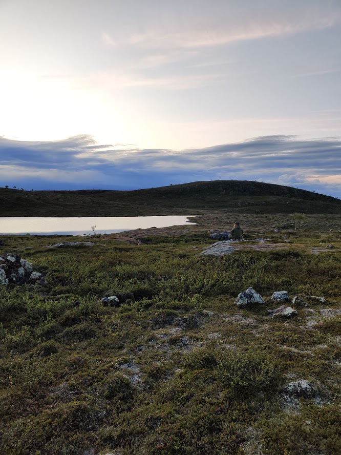
The sun setting behind the fells.
The uneven ground didn’t disturb my beauty sleep. Angry hydration during the evening was so successful that I had to get up to pee in the middle of the night in pouring rain. The rain continued throughout the night and lulled me back to sleep very quickly.
Essi: I wasn’t able to fall asleep and during the sleepless hours I wondered (don’t ask me why :D) that if Tero and me were burlesque artists, what would be our horror burlesque names. I might have to be Slimy Tits because it was a hot and humid night and I felt quite yucky after the day’s walk. When Tero stumbled out to pee, I asked him what he would want to be. A drowsy voice answered "Sleepy boi". So, there you go.
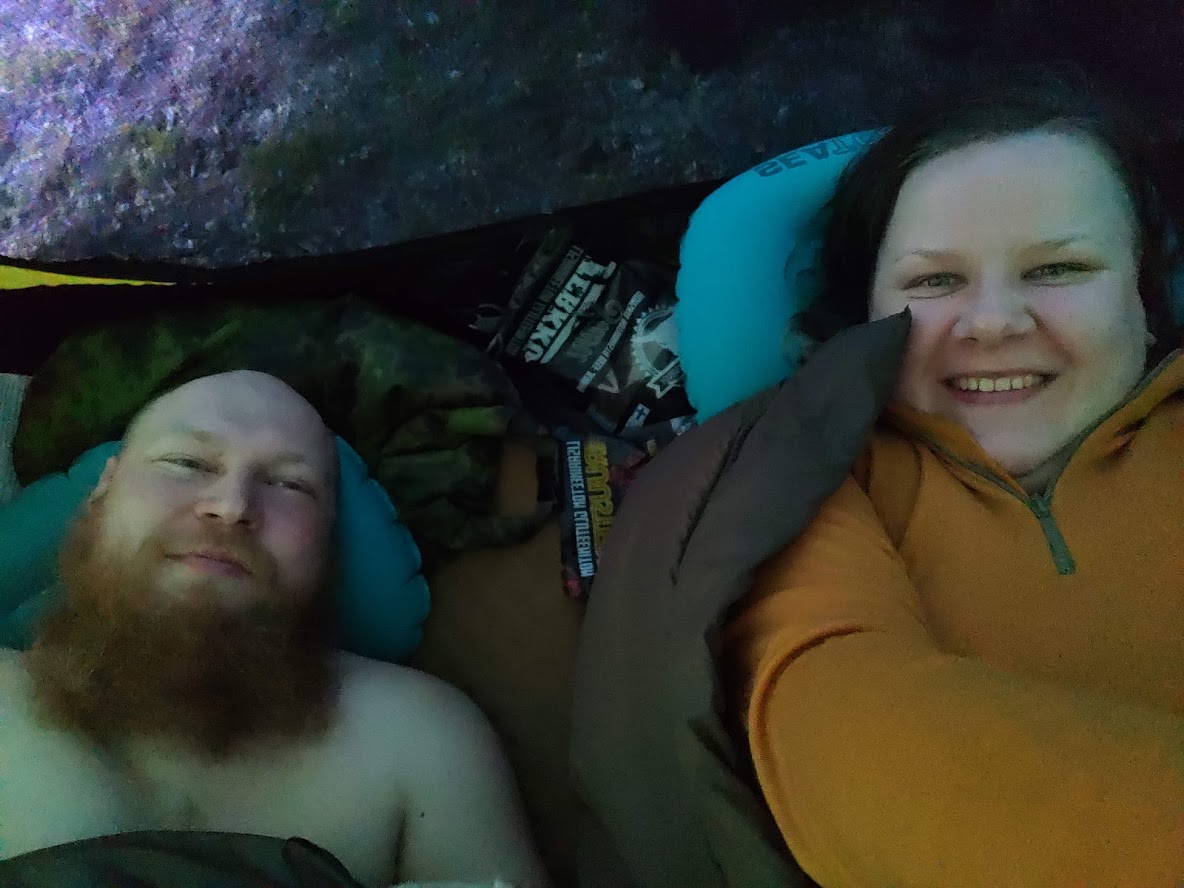
Sleepy boi and Slimy tits.
Day 6 Saturday
For the first time on this trip I woke up early. The rain was still hitting the tent so getting out of the sleeping bag didn’t feel that alluring. I wondered how my knife had handled the whole night alone in the rain. Luckily it was oiled. I snoozed lightly for another hour until it was impossible to fall asleep anymore.
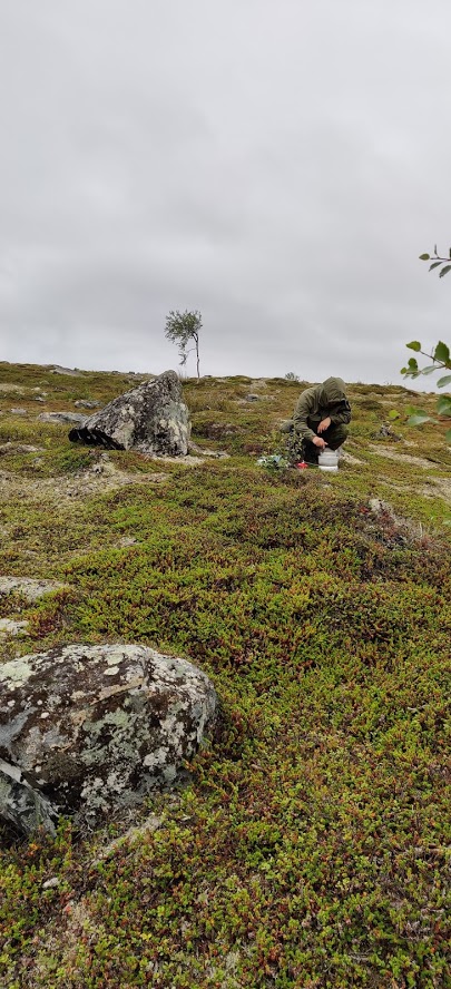
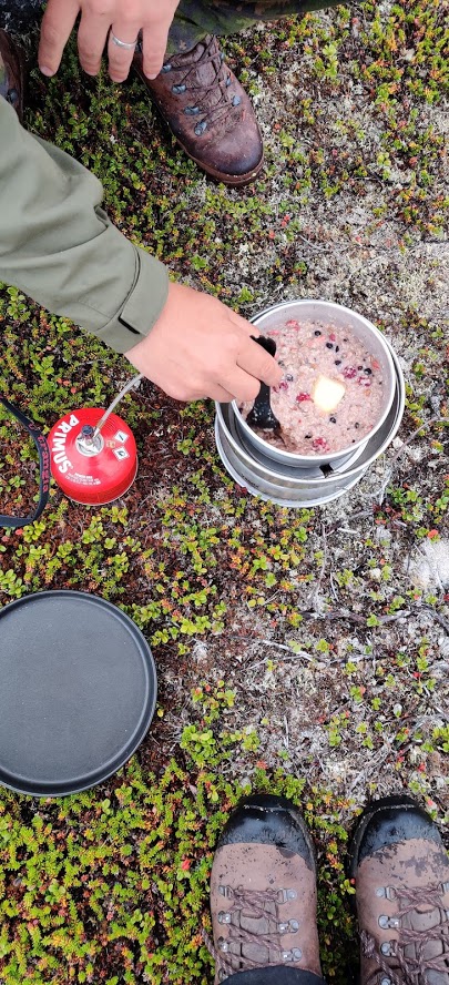
The last breakfast. A fistful of butter and the rest of the berries.
We had a quick breakfast since both were eager to get back because the rest of the way was familiar and short. It was only raining lightly when we packed up our things and began our brisk pace towards lake Pulmankijärvi. After a short while, it started raining a bit more but neither wanted to dig through the packs to find any rain gear since we were so close to the car. Well, in reality there were still quite a bunch of kilometers left, and the weather was getting worse and worse. After just a few minutes, all our clothes were so wet that the rain gear would be useless anyway. Well, it could be worse.
Even though the weather was cold and wet, the brisk pace kept us warm. When we were almost by the car, we decided to go even faster over the final swamp. When the hike was over, the only dry things were the boots and the backpacks that had been under the rain covers since the morning. The rain also stopped and our spirits were great despite all the wet stuff. We quickly changed into dry clothes, put everything in the car and started heading back south. A couple of hours later and we were already planning our next trip!
Essi: When we got in the car, we put on all the earworms that had tormented us during our trips. And there were quite a bunch of them. They did sound better through the car stereo than with our own lyrics. In case you want to find out what songs these were, here’s the list. They’re all in Finnish though. You an find them on our Spotify list.
- Ismo Alanko - Taitelijaelämää
- Veikko Lavi - Tavallinen Rellu
- Veikko Lavi - Silakka-apajilla
- Veikko Lavi - Ota löysin rantein
- Petri Nygård - Pannaan Suomi Kuntoon
- Korsuorkesteri - Veteraanin iltahuuto
- Hassisen Kone - Rappiolla
- Loituma - Ievan polkka
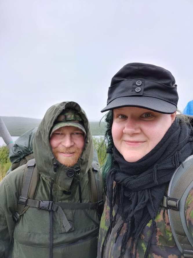
We made it!
Epilogue
This adventure went very well and quite like we planned. We got to explore new places, and the venture wasn’t too harsh unlike the Halti hike. We got some fish even though we didn’t fish that much. We ascended several fells, saw streams, rivers, lakes, reindeer, Aunt Ju, and Aatu. We didn’t have to meet that many people and the bugs didn’t bug us too much. We didn’t see that many mosquitoes or blackflies but there were some biting midges. Before the trip, we read some stories about reindeer warble flies that primarily pester the reindeer but that lately have also targeted humans in the Nordic countries. This fucktard lays eggs in the scalp and the maggots burrow under the skin and live on the tissue there. One more reason to wear a hat.
We had some food left but better this way than having it run out. In future, we will most likely dry more food on our own to ensure that we have stuff we like. Lighter backpacks made daily hikes easier and you often felt that you could have gone further. When the backpack weighs 20 kg or less, the Berghaus Atlas works very nicely. Anything heavier than this and it is better to take along a sturdier external frame backpack, such as a Särmä TST RP80.
The British army surplus boots made by Haix worked really well in versatile terrain. My feet didn’t start to hurt the same way as on the last hike when I had a lighter backpack and stiffer boots. Särmä Windproof Anorak has become a standard piece of equipment for me on our journeys. I have worn it everywhere from wintery fells in Lapland to summery shrubberies in southern Finland. Essi wore Särmä Outdoor Pants and Särmä Jorma Hunter's Jacket.
Underneath we both had merino wool, which works really well in all sorts of outdoor activities. I had the Särmä Merino Wool T-shirt and Särmä Merino Socks. In addition to similar socks, Essi also wore the Särmä TST L1 T-shirt, Särmä TST L1 Boxers, Särmä Merino Sports Bra, and Särmä Premium Merino Socks.
I am still annoyed by the lost Jääkäripuukko that had served me well for a few years. Luckily I know a place where I can get more of them. Now we are wise enough to say that it would have been good to spend a day or two just in the camp. One shouldn’t always hurry back to the trail.
Essi: As mentioned before, this was our second time in the Kaldoaivi wilderness area. The coolest thing for us there is that it is so huge and therefore has a very rich biodiversity. The southern parts have more forests with tall trees and shrubbery. The further north you go, the more rugged and barren the scenery gets. There are fewer trees and bushes and the altitude differences are bigger.
For us hermit types, Kaldoaivi is also quite nice because it has relatively few other hikers. This time we saw approximately five people. In 2017, when we followed the official hiking trail, we still only saw a handful of people. As camping and hiking become more popular, more people will of course find these routes.
Thanks to the colder northern climate, Kaldoaivi has quite a lot of meltwater even in the July, which can make it more difficult to cross the rivers. In 2017, when our hike took place at the end of July, hikers on the same route had to turn back two weeks earlier because the water was too high for crossing. We recommend going there in late summer when the mosquitoes won’t trouble you that much either!
In 2020, we plan on exploring a bit more western parts of Lapland. Our goal is to go and check out the Lemmenjoki National Park, the Kevo Canyon, and the Paistunturi Wilderness Area. We shall see what kinds of adventures we will find there!
Lapland is kind of a second home for us. Every time you leave from there, you feel like you leave a piece of yourself behind. Because of this, we spend nearly all our vacations in Lapland. August 2020, we will see you again!
You can follow Essi's and Tero’s adventures on Instagram at Beneath the Northern Sky